
Hot deserts and desertification
边玩边学
回答这些题目来赚取能量,然后钓鱼探索。无需账号。
给教育者: 面向 Hot deserts and desertification(Geography,Physical Geography)的即用型课程幻灯片, 复习笔记——用在你的课堂上,或将该知识点作为学习者可实时游玩的互动课堂活动来运行。
课程笔记
Hot desert environments
- Many hot deserts occupy broad subtropical belts, including parts of the Sahara, Arabia and Australia, with the Thar spanning India and Pakistan. Subtropical descending air suppresses cloud, but currents, relief, continentality and seasonal circulation also affect dryness. About 250 mm annual precipitation is a useful general guideline; water balance, variability and seasonality better explain aridity than one exact boundary.
- Clear skies and low moisture can produce large daily temperature ranges, but nights do not always become cold or freeze. Desert surfaces include rocky plateaux, gravel and sand; sand dunes are not the whole environment. Soils often have low organic matter and slow biological processes, but texture, nutrients, salts and fertility vary.
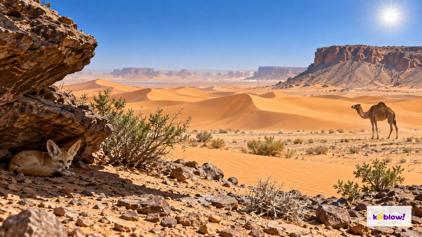
- Sparse cover reflects water constraints rather than an absence of life. Plants, animals and people occupy varied habitats, including places with groundwater access. The imagined desert figure combines rock, dunes, shrubs, a sheltered fennec and a camel without identifying a real site or providing measured temperature or rainfall.
Imagined hot-desert habitats
Adaptations
- Xerophytes use different strategies. Cacti may store water in succulent stems, have a waxy surface and spines, and use widespread shallow roots after rain. Other plants access deeper water or survive dry periods as dormant seeds. Cacti are mainly native to the Americas; do not treat them as a universal native feature of the Sahara.
- Animal adaptations include insulation, surface area, water conservation and activity patterns. Fennec ears can assist heat exchange and hearing, while shelter and nocturnal activity reduce heat exposure. Camel humps store fat, not water tanks, and broad feet support movement on yielding ground. Explain the mechanism and relevant conditions rather than assigning every trait to every animal.
Link an adaptation to a function
Opportunities and challenges
- Some desert regions offer minerals, oil or gas, solar resources, tourism and irrigated farming. Opportunity depends on actual deposits, infrastructure, water, permissions, skills and access. Noor Ouarzazate in Morocco is a solar-complex example including concentrated solar power; a place name is not evidence of cost-free or impact-free energy.
- Development faces water reliability, extreme conditions, dust, remoteness and maintenance costs. Energy and farming projects need assessment of land rights, water abstraction, technology, storage and grid or market access. Some solar technologies use water for cooling or cleaning, with requirements varying by design.
- Evaluate local employment and revenue against habitat, water, waste, emissions and rehabilitation effects. Tourism income may be seasonal and uneven. Drip irrigation can reduce some losses per unit of production but can require money, energy, maintenance and salt management; expanding irrigated land may prevent a reduction in total water use.
Evaluate a desert opportunity
Desertification
- Desertification means land degradation in arid, semi-arid and dry sub-humid regions through climatic variations and human activities. It is loss of land function and productivity, not necessarily a desert edge advancing or all ground becoming sand. The Sahel is a diverse transition zone south of the Sahara, with seasonal and interannual rainfall variation.
- Grazing beyond vegetation recovery, clearing cover faster than regrowth, cultivation that depletes soil and poor irrigation can reduce cover, compact or deplete soils, increase erosion or cause salinity and water stress. Sustainable pastoralism, harvesting and cultivation differ from these damaging practices. Population change acts through demand, resource access, management and institutions; it is not an inevitable direct cause.
- Warming can raise evaporative demand, and changing rainfall, drought and extreme runoff can interact with land-use pressures. Not every dryland follows one trend, and additional rain is not an automatic restoration strategy where bare soil sheds runoff. Assess soil function, cover, water balance and livelihoods rather than judging degradation solely by how green one seasonal photograph looks.
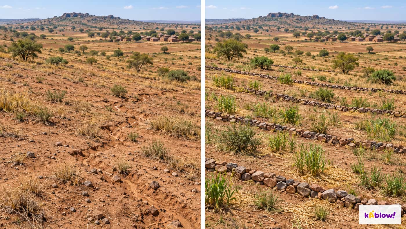
Imagined dryland management comparison
Reducing the risk
- Match measures to the problem and the site: cover or mulch can protect soil, permeable contour stone lines can slow runoff and trap sediment, and appropriate regeneration can retain suitable woody cover. Grazing management needs recovery time, mobility, access and local agreement. A single fence or planting campaign cannot replace a functioning land-use system.
- The African-led Great Green Wall initiative aims to restore degraded landscapes and livelihoods in the Sahel. It should not be presented only as one continuous line of trees, and targets are not proof of achieved outcomes. Suitable species, survival, soil and water management, secure access, conflict conditions, funding, maintenance and participation determine results.
- Appropriate technology fits local needs, knowledge, resources and maintainability and can be simple or sophisticated. Efficient stoves may reduce wood demand if adopted and maintained; wells require sustainable abstraction; drip systems need maintenance, drainage and salinity management. Monitor long-term land function and livelihoods as well as installation numbers. The invented restoration comparison is a teaching illustration, not an actual project’s before-and-after evidence.
幻灯片
练习题
免费预览——33 题中的 8 题。注册即可查看全部。
1.Which annual rainfall amount is a common GCSE guideline for desert conditions?
Easy- Aless than 250 mm a year
- B2000 mm
- C1000 mm
- D500 mm
2.What is desertification?
Easy- Aa desert becoming a forest
- Bice melting
- Ca river drying
- Dland degradation in drylands due to climatic variations and human activities
3.Which animal adaptation helps lose heat?
Easy- Awebbed feet
- Ba long neck
- Clarge ears of a fennec fox
- Dthick fur
4.What do cacti store in their stems?
Easy- Afat
- Bwater
- Csunlight
- Dsand
5.What is a diurnal range?
Easy- Athe difference between a day’s maximum and minimum temperatures
- Brainfall
- Cwind speed
- Dsoil depth
6.How can subtropical atmospheric circulation contribute to hot-desert dryness?
Easy- Alow pressure brings rain
- Bthey are near the poles
- Cthey have forests
- Ddescending air warms and suppresses cloud formation
7.Which is an opportunity in deserts?
Easy- Adense forests
- Bfloods
- Cmineral extraction
- Dheavy rainfall
8.Which is a challenge for development in deserts?
Easy- Afertile soils
- Bextreme heat and lack of water
- Cabundant water
- Dmild climate
历年真题
该知识点的历年真题练习即将推出。
即将推出