
Tropical rainforests
Apprends en jouant
Réponds à ces questions pour gagner de l'énergie, puis pêche et explore. Sans compte.
Pour les enseignants : diapos de leçon, notes de révision prêts à l'emploi pour Tropical rainforests (Geography, Physical Geography) — utilise-les en cours, ou lance le thème en activité de classe interactive que tes apprenants jouent en direct.
Notes de leçon
Climate, soils and vegetation
- Tropical rainforests occur in warm, moist tropical regions, including parts of the Amazon and Congo basins and Southeast Asia. The distribution is wider than an exact 5° north–south belt. Around 27°C and annual rainfall around or above 2,000 mm are examples for many lowland settings, not universal thresholds or a description of every montane forest.
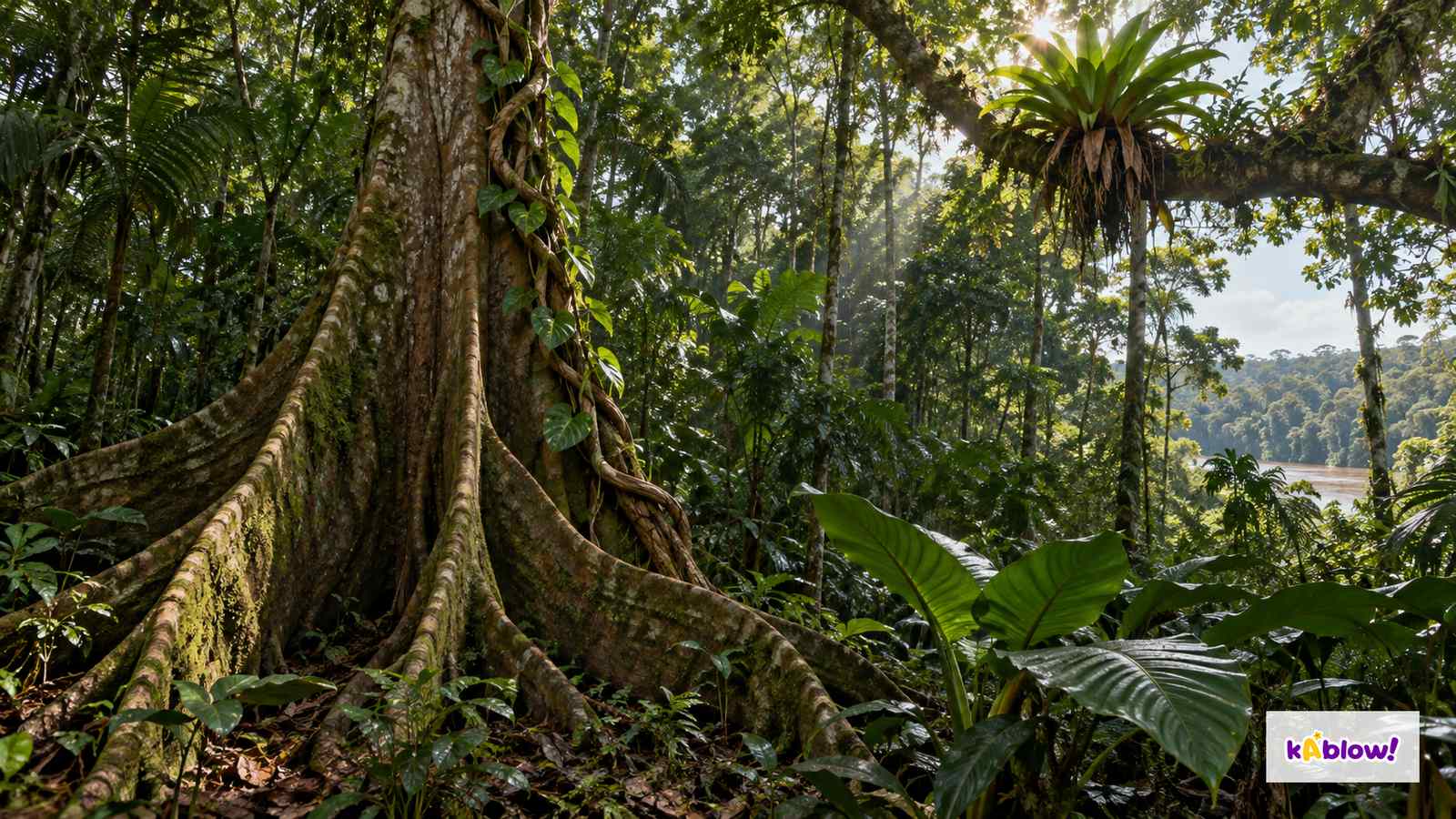
- A common simplified structure is emergent trees above a canopy, an understorey below and a shaded forest floor with litter and decomposers. Real structure includes gaps and varies with species, terrain and disturbance. Biodiversity includes genetic, species and ecosystem variation; high species richness is only one aspect.
- Many old tropical soils are deeply weathered and have low readily available supplies of some nutrients, but soil depth, parent material, age, drainage and fertility vary substantially. A thin organic litter/humus layer does not imply a thin whole soil profile. Leaching moves dissolved substances with percolating water; erosion removes particles physically.
- Warm, moist, aerated conditions can support rapid decomposition and nutrient uptake, with important biological recycling. Waterlogging and other limitations alter these rates. Nutrients are not taken up instantly, and large biomass does not prove either universally fertile or universally infertile soil.
Distinguish two processes
Adaptations
- Drip tips can help drain leaf water; buttresses support some large trees; epiphytes grow on hosts for support without necessarily being parasitic; lianas are rooted woody climbers. Traits vary by species and conditions. The imagined close-up illustrates structures rather than experimentally proving their function or soil depth.
- Animal strategies include movement, feeding, camouflage and use of different heights and habitats. Do not combine region-specific species into a factual local community: jaguars and many familiar New World monkeys belong to American examples, while orangutans belong to Southeast Asia. A generic forest illustration is not a wildlife census.
Imagined plant growth strategies
Deforestation
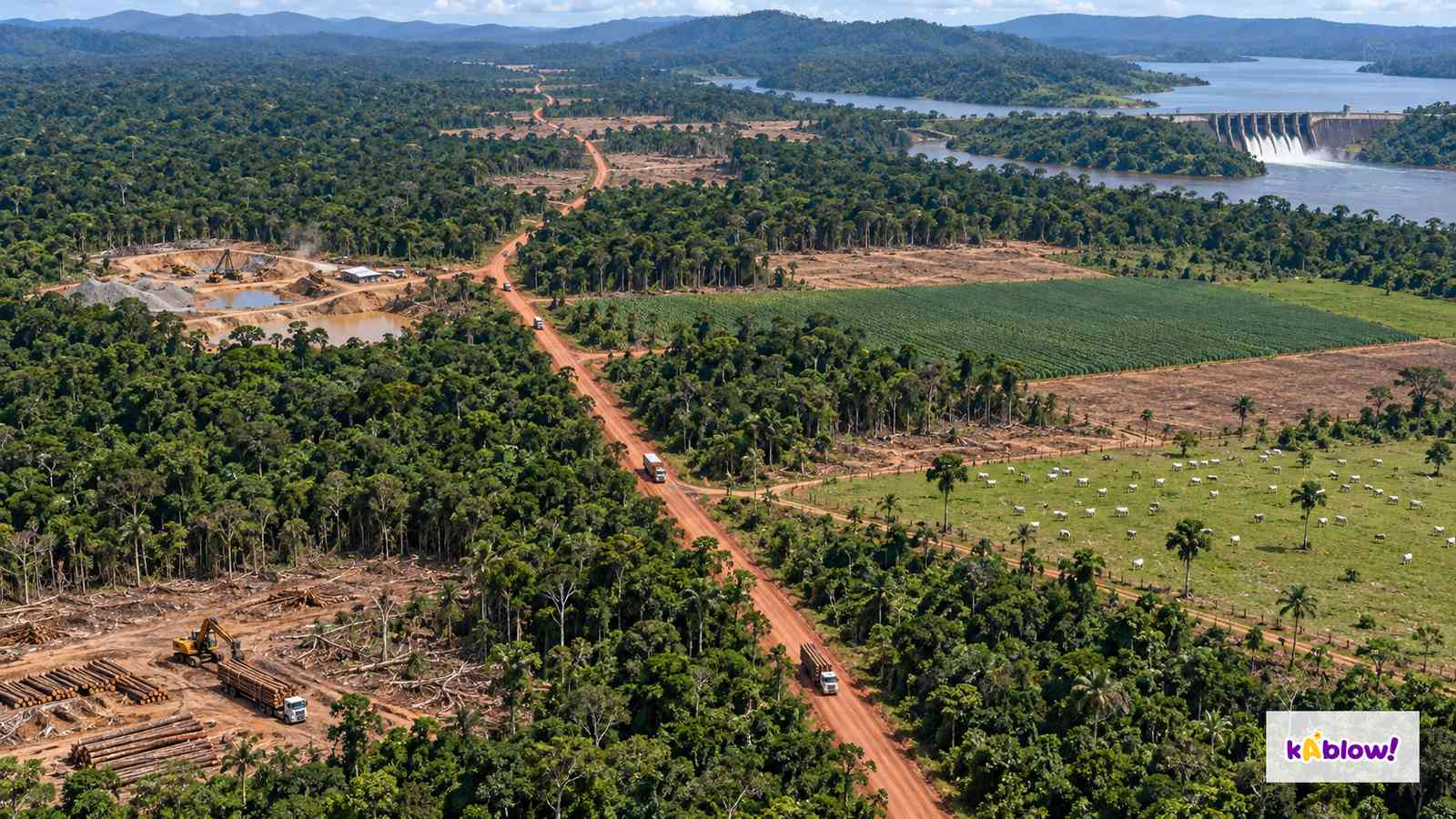
- Deforestation is conversion of forest to another land use or long-term loss of forest cover; degradation reduces forest condition without necessarily converting it. Clearing for cattle pasture, crops, oil-palm plantations, infrastructure, mines or reservoirs can contribute, with major differences among regions. Logging can cause damage and facilitate later conversion but is not automatically the same as permanent clearance.
- Removing or fragmenting habitat threatens forest-dependent species and ecological links. Burning and decomposition release carbon, while changes in cover and later use affect storage and uptake. Loss of canopy, litter or soil structure can alter runoff, evapotranspiration and erosion, with slope, storm, drainage and land use affecting the outcome.
- Economic activities can bring jobs, revenue and services while imposing unequal environmental and social costs. Indigenous and other forest-dependent communities have diverse knowledge, rights and views; clearance can affect territory, food, livelihoods and cultural places. Subsistence farming is production mainly for household use and is not inherently destructive in every system.
Imagined pressures on tropical forest
Sustainable management
- Selective and reduced-impact logging require suitable harvest levels, reduced collateral damage, regeneration and monitoring. Protected areas need resources, enforcement and community/Indigenous rights. Ecotourism needs evidence of limited ecological impact and fair local benefits, rather than a label alone.
- Restoration can recover some cover, carbon and habitat, but species composition, structure, soil and relationships recover at different rates. Plantations do not automatically replace native old-growth forest. Avoid a fixed universal recovery time and prioritise protection of existing forest alongside appropriate restoration.
- FSC 100% identifies forest materials from FSC-certified forests; FSC Recycled identifies recycled materials; FSC Mix can combine certified, recycled and/or controlled sources. These labels have different meanings, not one guarantee that all labelled material is entirely new certified wood. Debt-for-nature arrangements link debt restructuring or reduction to conservation finance or commitments and require governance and verified outcomes.
- REDD+ covers emissions from deforestation and forest degradation, plus conservation, sustainable forest management and enhancement of forest carbon stocks. Monitoring, permanence, displacement of clearance elsewhere, rights and benefit-sharing matter. A funding pledge, target or agreement does not by itself prove lasting carbon or biodiversity gains.
Check what a management claim means
Case study
- Use Rondônia in the Brazilian Amazon as a dated regional example. NASA’s article published on 28 May 2009 compared observations from 12 August and 30 September 2007. It described branching road access and fishbone clearings as one deforestation trajectory, with potential movement from crop clearings to pasture and consolidation into larger holdings.
- The historical account links access, land-use change and fragmentation, but it is not a present-day deforestation rate, a controlled proof of each household’s motive or a description of the entire Amazon basin. The lesson’s pressure landscape is an imagined composite, not those satellite images.
- Evaluate employment and land-use benefits alongside habitat connectivity, carbon, soil/water effects and community rights. Describe the place, observation dates and source scope before generalising, and use further dated evidence for claims about present trends or policy effectiveness.
Rondônia: date and scope
Diapos
Sign up free to view the lesson slides
Step through every slide for this topic — plus flashcards and revision notes — with a free account.
Questions d'entraînement
Aperçu gratuit — 8 sur 33 questions. Inscris-toi pour toutes les voir.
1.Where are tropical rainforests found?
Easy- Anear the equator
- Bat the poles
- Cat 60°N
- Dat 40°S only
2.What is the highest layer of a rainforest?
Easy- Acanopy
- Bunderstorey
- Cforest floor
- Demergent
3.What are drip tips?
Easy- Aflowers
- Bfruit
- Cpointed leaf tips that shed rain
- Droots
4.What are epiphytes?
Easy- Aroots
- Bplants that grow on branches
- Cground plants
- Dfungi
5.What does 'biodiversity' mean?
Easy- Athe variety of life within species, between species and among ecosystems
- Bthe number of trees
- Cthe temperature
- Dthe rainfall
6.Why can many old, strongly weathered tropical soils have low available nutrients?
Easy- Athere is no rain
- Bthe soil is frozen
- Cthe soil is rocky
- Dweathering, leaching and nutrient constraints can limit available supplies
7.Why is the nutrient cycle fast?
Easy- Athere are no plants
- Bnutrients are stored for years
- Cwarm, wet conditions speed decay
- Dit is cold
8.Which is a direct example of deforestation through land conversion?
Easy- Aflooding by sea
- Bclearing native forest to establish cattle pasture
- Ctourism only
- Dreforestation
Unlock all 33 questions & more
Crée un compte gratuit pour voir toutes les questions, les diapos, les cartes mémo et les notes de révision de ce thème.
Annales
Les annales d'entraînement pour ce thème arrivent bientôt.
Bientôt disponible