Natural hazards
遊んで学ぼう
問題に答えてエネルギーを集めたら、釣りや探検を楽しもう。アカウント不要。
教育者の方へ: Natural hazards(NGSS Middle School Science、Earth and Space Science)向けのすぐ使えるレッスンスライド, 復習ノート, 図解 — レッスンで使うか、学習者がライブゲームとして遊ぶインタラクティブなクラス活動としてトピックを実施できます。
レッスンノート
Geologic Hazards and Human Impact
- Natural hazards are events in nature that can harm humans or property; they cannot be stopped.
- Geologic hazards include earthquakes, landslides, floods, volcanoes, sinkholes, and rockfalls.
- Atmospheric hazards include tornadoes, hurricanes, floods, avalanches, blizzards, and windstorms.
- Hazards can cause billions of dollars in damage and loss of life, as seen in the 2015 Nepal earthquake.
- Some areas are more prone to hazards due to their location (e.g., fault lines, tornado alley).
Earthquakes
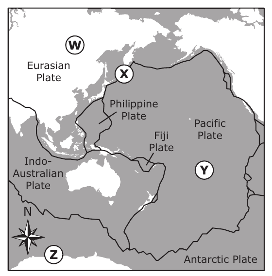
- Earthquakes occur when tectonic plates get stuck and then release stored energy.
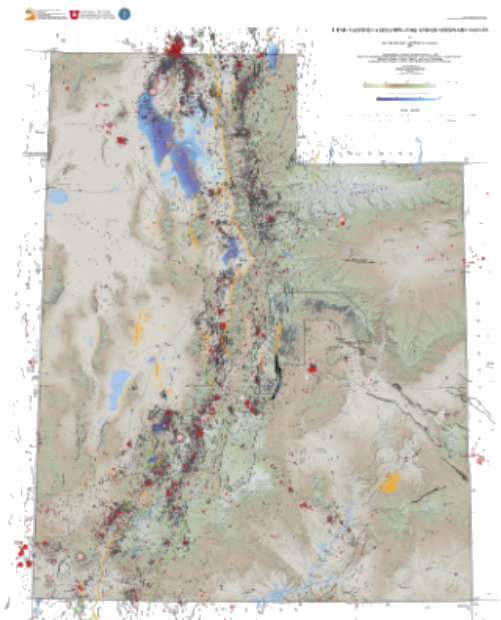
- They can happen along fault lines; Utah has over 200 active faults.
- Earthquakes are difficult to predict; we can only give general probabilities (e.g., '50% chance in 50 years').
- Seismometers measure earthquake activity but cannot predict them.
- Earthquake damage can be reduced by anchoring buildings to bedrock, using flexible materials (wood, steel), and base isolation (rollers or rubber layers).
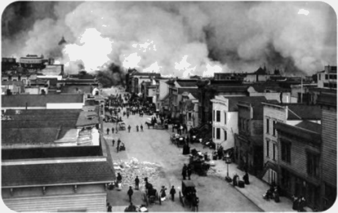
San Francisco after the 1906 earthquake, with smoke rising from fires
Landslides
- Landslides are sudden falls of rock or earth, moving at speeds up to 200-300 km/h.
- They are triggered by gravity, steep slopes, and often water (heavy rain).
- Landslides can destroy homes, bury villages, and create lakes by damming streams.
- They can trigger tsunamis if they flow into lakes or bays.
- Predicting landslides is possible in general areas (steep, unstable slopes) but not exact timing.
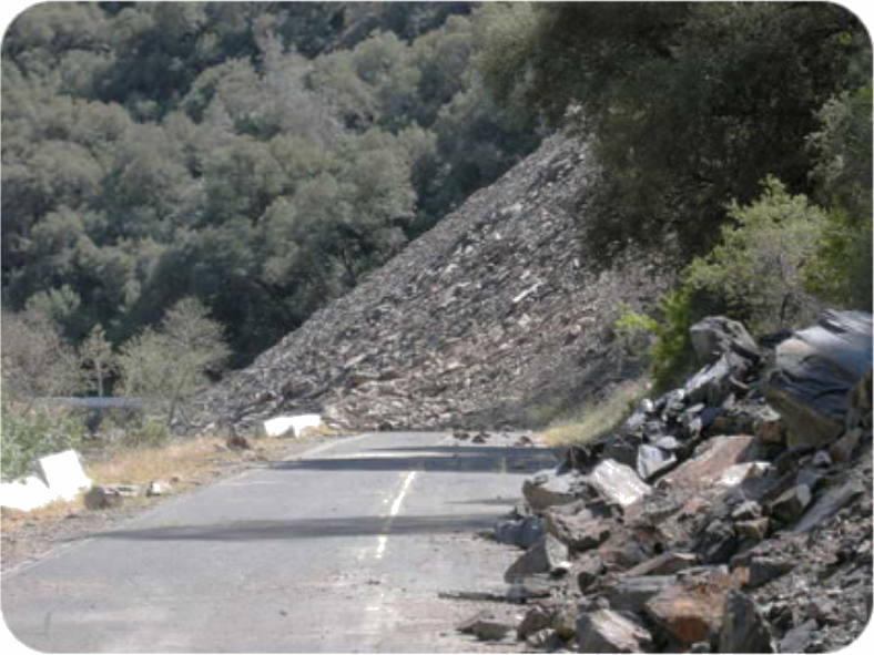
A landslide covering a road
Floods
- Floods occur when water overflows river banks due to heavy rain or rapid snowmelt.
- They are a natural part of the water cycle but can cause massive damage and loss of life.
- Floods can be predicted with weather monitoring (e.g., heavy rain forecasts).
- Building on stilts (as in Louisiana) can reduce flood damage.
- Flood risk is higher in areas with poor drainage or near rivers.
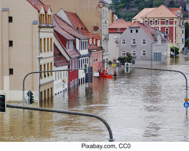
A flooded street with buildings partially submerged and a rescue boat.
Predicting Natural Hazards
- Prediction involves where and when a hazard may occur.
- Some hazards (tornadoes, hurricanes, volcanic eruptions) have precursors that allow short-term warnings.
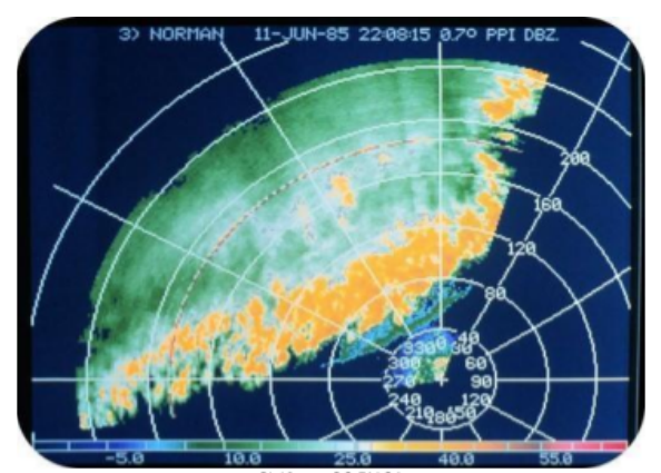
- Tornadoes are often predicted hours in advance using Doppler radar.
- Hurricanes are tracked via satellite images and have seasonal patterns (June-November).
- Volcanic eruptions are often preceded by small earthquakes.
- Earthquakes and sinkholes are unpredictable in timing; only general risk areas are known.
Doppler radar image of a line of thunderstorms
Engineering Solutions for Stability
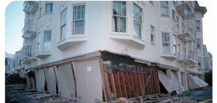
- Retrofitting older buildings with steel or wood reinforces them against earthquakes.
- Skyscrapers on soft ground must be anchored to bedrock.
- Buildings can be placed on rollers or layers of steel and rubber to absorb shock.
- Counterweights and diagonal steel beams limit swaying.
- Zigzag pipes and valves in gas/water lines reduce fire risk during earthquakes.
- Cost is a major constraint; communities must weigh hazard risk vs. building costs.
A building damaged by an earthquake, illustrating the need for engineering solutions for stability.
Wildfire Patterns and Precipitation
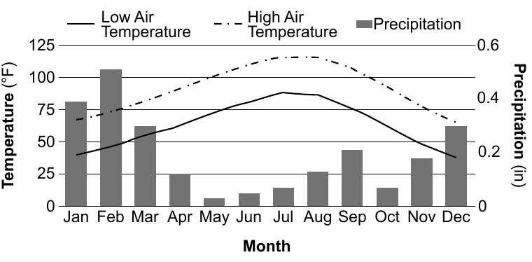
- Wildfires are more likely in dry conditions with abundant dried vegetation.
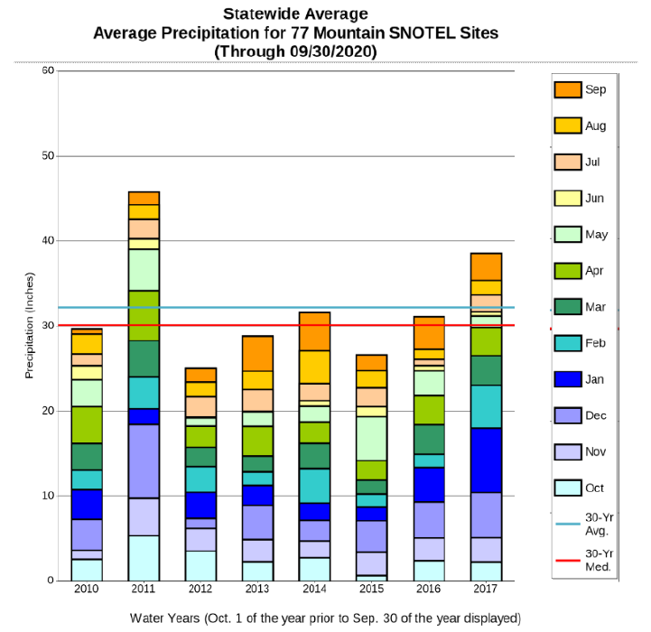
- High precipitation in one year can lead to more plant growth, which later becomes fuel for fires.
- Utah wildfire data shows variation by year; the year with most wildfires likely followed a wet year.
- Drought following wet years increases wildfire risk.
- People can lessen damage by clearing vegetation and creating firebreaks.
Mitigation Technologies and Warning Systems
- Tsunami buoys detect ocean waves and send warnings to coastal areas.
- Avalanche control uses explosions to trigger avalanches safely.
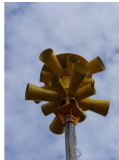
- Warning systems (sirens, TV, cell phones) communicate hazards to residents.
- Satellite imagery tracks severe weather and volcanic ash.
- Doppler radar helps predict tornadoes and severe storms.
- Investing in warning systems can save money and lives, as seen with tsunami warnings.
A warning siren
Analyzing Hazard Data
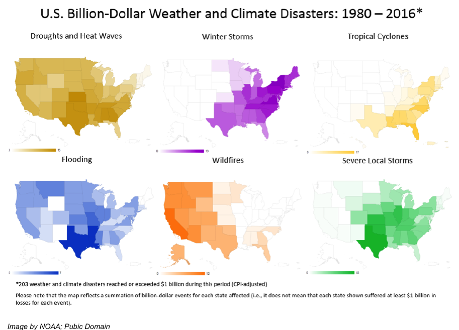
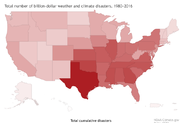
- Maps of hazard occurrences help identify high-risk areas (e.g., tornado alley, hurricane coasts).
- Sinkholes are more common in areas with soluble rock (e.g., Florida, Texas).
- Tornadoes are most frequent in the central U.S. (Tornado Alley).
- Hurricanes mainly affect the Gulf Coast and East Coast.
- Earthquake risk is highest near plate boundaries (e.g., California, Alaska).
- Utah has medium to high risk for earthquakes and moderate risk for other hazards.
Map of billion-dollar weather and climate disasters by state, 1980-2016
Case Study: California Memorial Stadium
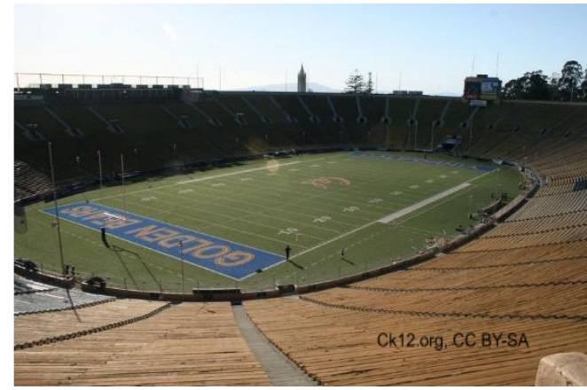
- Built in 1922 on the Hayward Fault, which passes beneath both end zones.
- Renovated for $321 million to improve safety.
- Renovations included 10 miles of steel cables, silicone fluid-filled shock absorbers, concrete piers, and stone columns.
- Also used 3 feet of sand and plastic sheeting to reduce shaking.
- This shows how engineering design can mitigate earthquake hazards.
California Memorial Stadium
スライド
練習問題
無料プレビュー — 44問中8問。すべて見るには登録を。
1.What is a natural hazard?
Easy- AAn event that occurs in nature that has the potential to cause harm to humans or their property
- BAn event that always causes destruction and loss of life
- CA man-made event that causes damage
- DA weather event that only occurs in the atmosphere
2.Earthquakes, landslides, and floods are all examples of geologic hazards.
EasyTrue or false?
3.Which of the following is an atmospheric hazard?
Easy- AEarthquake
- BLandslide
- CHurricane
- DSinkhole
4.A natural hazard becomes a natural disaster only when it causes significant damage or loss of life.
EasyTrue or false?
5.Which of the following is a factor that increases a community's vulnerability to natural hazards?
Easy- ABuilding structures on soft ground without anchoring to bedrock
- BUsing wood and steel in construction
- CInstalling early warning systems
- DRetrofitting old buildings
6.Which of the following are methods used to predict natural hazards? (Select all that apply)
Easy- AMonitoring seismic activity for earthquakes
- BUsing Doppler radar for tornadoes
- CTracking satellite images for hurricanes
- DObserving animal behavior for landslides
- EMeasuring precipitation for floods
7.Which of the following is a mitigation strategy for earthquakes?
Easy- ABuilding on soft ground
- BUsing brick and stone for construction
- CAnchoring skyscrapers to bedrock
- DPlacing buildings on stilts
8.Match each natural hazard to its type.
Easy- Earthquake
- Tornado
- Landslide
- Geological
- Atmospheric
過去問
このトピックの過去問練習は近日公開。
近日公開