Climate and global circulation
邊玩邊學
回答這些題目賺取能量,接著就能釣魚、探索。不需要帳號。
給教育者: 為 Climate and global circulation(NGSS Middle School Science、Earth and Space Science)準備好可直接使用的課程投影片, 複習筆記, 圖表——用於你的課程,或把這個主題當成互動班級活動,讓學習者以即時遊戲的方式進行。
課程筆記
Unequal Heating and Latitude
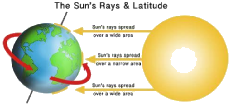
- The Sun's rays strike Earth's surface most directly at the Equator, making it warmer.
- Near the poles, the Sun's rays are less direct and spread over a wider area, so temperatures are lower.
- Latitude (distance north or south of the equator, measured in degrees) causes unequal heating of Earth's surface.
- Places receiving more solar energy are warmer; places receiving less are cooler.
- Warm air rises and cool air sinks, driving atmospheric circulation that redistributes heat.
The Sun's rays and latitude
Atmospheric Circulation
- The atmosphere forms convection cells that move air from the equator toward the poles and back.
- There are three main air cells in each hemisphere, averaging out the movement of air.
- Atmospheric circulation brings warm air toward the poles and cold polar air toward the equator.
- This movement moderates Earth's temperatures, balancing heat between warm and cold regions.
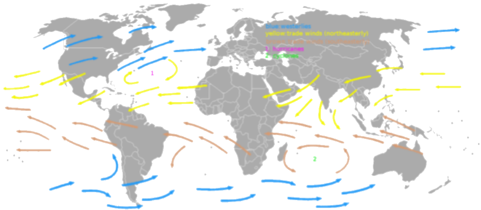
- Global winds blow consistently in the same direction, influenced by unequal heating and Earth's rotation.
Global wind patterns showing westerlies and trade winds
Oceanic Circulation
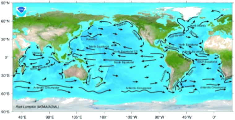
- Wind patterns push ocean water, creating surface currents that can flow for thousands of kilometers.
- Surface currents distribute heat around the planet and are a major factor influencing climate.
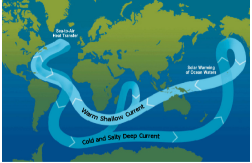
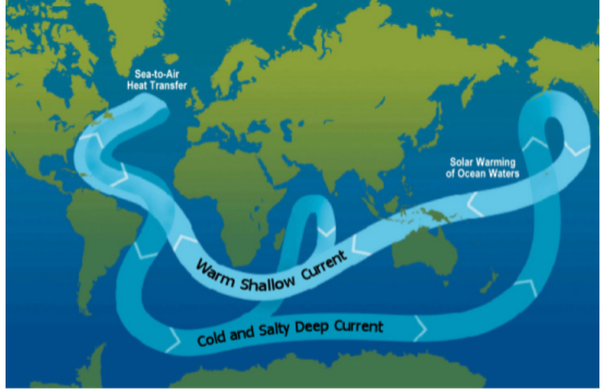
- The global conveyor belt describes the movement of warm water from the equator to the poles, where it cools, sinks, and returns.
- The Gulf Stream is a warm ocean current that carries heat from the equator to Europe, raising temperatures and precipitation.
- Ocean currents transfer heat from equatorial regions to higher latitudes, preventing extreme climate differences.
The global conveyor belt showing warm shallow currents and cold salty deep currents.
Temperature Inversions
- A temperature inversion occurs when air temperature in the troposphere increases with altitude, with warm air sitting over cold air.
- Inversions are stable and can last for days or weeks, trapping pollutants and causing unhealthy air in cities.
- They form over cold ground at night or in winter, or near coasts where cold seawater cools the air above it.
- The cooler, denser air is trapped beneath warmer, less dense air, preventing mixing with the stratosphere.
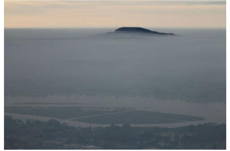
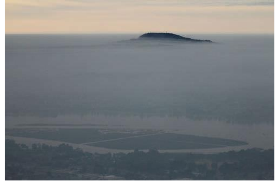
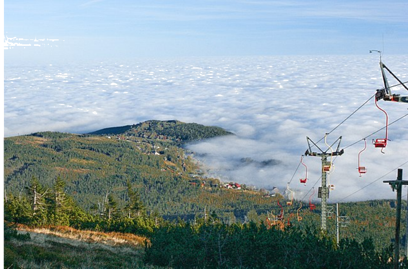
- Salt Lake City experiences winter inversions, where the valley is covered in fog-like clouds while the mountains are clear.
A temperature inversion trapping pollutants over a city.
Altitude and Temperature
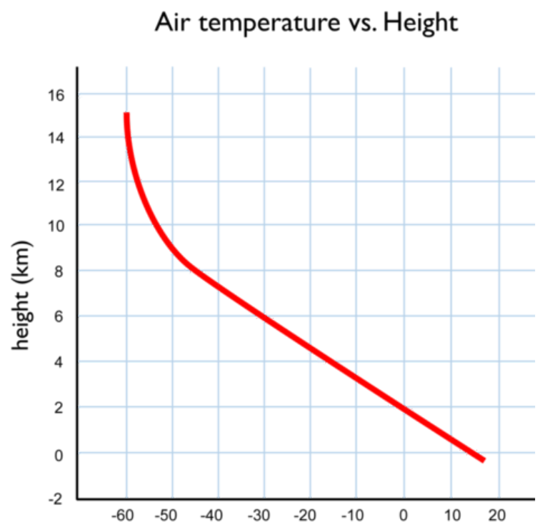
- Air temperature falls at higher altitudes because air is less dense, so its molecules collide less often and produce less heat.
- Latitude is not the only factor in climate — altitude matters too.
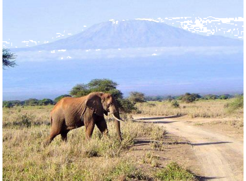
- Mount Kilimanjaro sits only about 3° south of the equator, yet its 6-kilometer peak is capped with snow year-round.
- A single mountain can have very different climates at its base and at its summit.
Air temperature vs. height
Mountains and Precipitation
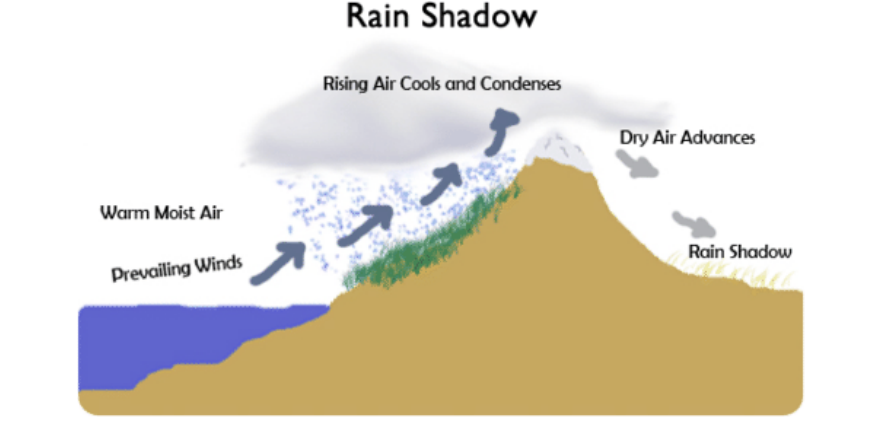
- Mountains can cast a rain shadow: as prevailing winds push warm, moist air up the windward side, the air cools and drops its moisture as precipitation.
- By the time the air crosses the peak, it has lost most of its moisture.
- On the leeward (far) side, the now-dry air sinks and warms, so very little precipitation falls there.
- Rain shadows are a geographic factor, alongside latitude and ocean currents, that shape a region's climate.
The rain shadow effect
Climate Definition
- Climate is the 30-year average of weather conditions in an area.
- Climate is determined by atmospheric and oceanic circulation, along with geographical factors.
- The transfer of energy from the equator to the poles, combined with other factors, creates areas with common weather patterns.
- Understanding climate requires considering both the atmosphere and the ocean as interconnected systems.
投影片
練習題
免費預覽——50 題中的 8 題。註冊即可查看全部。
1.What is the 30-year average of weather in an area called?
Easy- AClimate
- BWeather
- CTemperature
- DPrecipitation
2.Which of the following best describes latitude?
Easy- ADistance north or south of the equator, measured in degrees
- BDistance east or west of the prime meridian, measured in degrees
- CHeight above sea level
- DThe amount of solar energy received at a location
3.Surface currents are created by global wind patterns and the rotation of the Earth.
EasyTrue or false?
4.Why do places near the equator receive more solar energy than places near the poles?
Easy- AThe Sun's rays strike the equator more directly, focusing energy over a smaller area.
- BThe equator is closer to the Sun.
- CThe equator has more hours of daylight each day.
- DThe atmosphere is thinner at the equator.
5.Match each term with its correct description.
Easy- Climate
- Weather
- Latitude
- 30-year average of weather
- Current atmospheric conditions
- Distance from the equator
6.What is the primary reason that warm air rises and cool air sinks?
Medium- AWarm air is less dense than cool air.
- BWarm air is denser than cool air.
- CWarm air contains more water vapor.
- DCool air has more pressure.
7.The Gulf Stream is a cold ocean current that flows from the poles toward the equator.
EasyTrue or false?
8.Which of the following best explains why London has a milder winter than Quebec, despite being at a similar latitude?
Medium- ALondon is warmed by the Gulf Stream.
- BLondon is closer to the equator.
- CQuebec is at a higher altitude.
- DLondon receives more direct sunlight.
歷屆試題
這個主題的歷屆試題練習即將推出。
即將推出